• Login
  • About us
  • Contact us
  • Login
  • About us
  • Contact us
;
Gujarat District FactbookTM : Sabar Kantha District Share
Gujarat District Factbook : Sabar Kantha District
Sabar Kantha District, in the North Region region is a district of Gujarat with its administrative headquarters located at Himatnagar city. According to 2011 census, the district encompasses a geographical area of 7394 sq km and has a population of 24,28,589 (persons) including 12,44,231 (males) and 11,84,358 (females). The district has a sex ratio of 952 (females for every 1000 males. The major religions in the district are Hindu (93.08%) and Muslim (6.12%) of the total population respectively. The literacy rate in the district is 75.79% (persons), 86.44% (males) and 64.69% (females). Main spoken languages are Gujarati (97.86%), Hindi (1.63%), Lahnda (0.12%). Labour Force Participation Rate is 75.83% for the year 2022-2023. Main source of income in the district is from the agriculture sector. The crime rate in the district is 115.41 for the year 2022. Total cropped area is 3,94,389 in hectares and the forest area is 811.58 in sq km (2021).
To know more about the Administrative Setup, Demographics, Economy, Market Size, Life Style, Infrastructure, Industries, Labour and Workforce, Agriculture, Education, Health, Environment and Pollution, Housing, Crime & Law, Social and Welfare Schemes and Electoral features of Sabar Kantha District, check the contents of District FactbookTM and its sample view. Click here to view complete list of available 620 District FactbookTM
Factoids
  • Reader friendly fact book since it is a one-stop guide of a particular district of India
  • Information are collected from reliable official sources such as government publications, reports of ministries and government websites
  • Comparative presentation of district ranks with state and national figures, so that one can easily make out where district stands in different socio-economic variables across the nation
  • Present almost all scattered information of the district in an encapsulate form
  • One District FactbookTM serves only one particular district of India
Contents
Administrative Setup
It provides names and the numbers of the Sub Districts/Tehsils, Towns and Villages in a district.
Demographics
This part covers the information on Overall Population, Population by Age Group, Economically Active Population, Child Population, Socio Religious Population, etc.
Economy
This section furnishes data on the district's GDP/NDP, Per Capita Income, Disposable Income, Banking performance, Ration Cards, Investment and Debt.
Market size
Presents data on Per Capita Household Potential Expenditure and Selected item wise Monthly Per Capita Expenditure.
Life style
This segment gives data on Households having Radio, TV, Telephone / Mobile, Computer / Laptop / Internet, two and four wheelers and daily circulation of newspapers.
Infrastructure
It covers data on Uses of Houses, Amenities, Sanitation, Road Length, Vehicle Registered, Post Office & Pin Codes, Electrified Villages and Tourist Places.
Industries
This part contains data on Factories, Capital Invested, Persons Employed, Factories by Type of Organisation/Ownership, ongoing projects and many more.
Labour and Workforce
It highlights data on Total Workers (Main, Marginal and Non workers), Daily Agricultural Wages and Employment Indicators.
Agriculture
This section provides data on Agricultural Land, Area under Major Food Crops/ its production, Commercial Crops, Fruit and Vegetable Crops, livestock etc.
Education
This sector gives data on Literacy Rate, Houses used as School/College, Gini Coefficient Education, Enrolment by Medium of Instruction, Mother Tongue and Gross/Net Enrolment Ratio, Number of Schools and Teachers.
Health
This part confers data on Health Institutions, Medical Staff, Vital stat of Live Births, Deaths, Infant Deaths, Disabled Population by Type of Disability, and Rural health centres etc.
Environment and Pollution
This section furnishes data on Geographical Area, Wastelands, Forest Cover, Rainfall, Latitude, Longitude and Altitude and Water Quality.
Housing
It gives information on households, houseless households, houseless population, Standard of Living, Housing Condition, House and their Uses, Slum Population, etc.
Crime and Law
Presents data on Incidence of IPC crime, Police Stations and Police Posts, Judicial Officers and Police officers/officials.
Social and Welfare Schemes
This section covers information on MGNREGS, SGSY, DRDA, NRDWP, NBA and UIDAI.
Electoral
It contains data on Number of Electoral in a district, Vote Distribution of Major Parties in Parliamentary and Assembly Election and Member of Panchayats.
Usefulness

This District FactbookTM is useful for:

  • Academicians
  • Social Science & Economic Researchers
  • Policy Makers
  • Government Officials
  • Media Persons
  • Marketers
  • Consultants
  • Strategic Planners
  • Political Scientists
  • NGOs
  • For Doing Business
  • Libraries
View Sample
Place your Order

Select your Country of Origin

India Other than India SAARC Nation

Select your State and District

Gujarat District FactbookTM : Sabar Kantha District

Select your required format

Print eBook eFlipBook
Print + eBook Print + eFlipBook
eBook Annual Subscription Web Based eFlipBook Annual Subscription
eBook Annual Subscription + Print Web Based eFlipBook Annual Subscription+Print

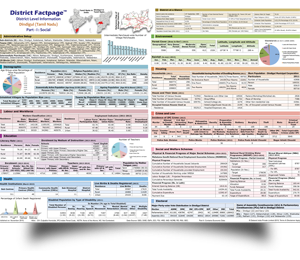
Description : Selected district level socio-economic data of Sabar Kantha District, Gujarat

Editor : Dr. R. K. Thukral

Edition : January 2024; HB ; 200 + Pages

ISBN : 978-93-5855-805-0

Price : Rs. 750010% OFF
Discounted Price : Rs. 6750

Shipping Charges : (Free courier/registered post charges within India)

Expected DeliveryTime Though every efforts will be made to deliver the ordered book within the mentioned time. However, due to some unforeseen reasons, an inadvertent delay may occur, which will be informed accordingly. : Within 3-5 working days or earlier

BROWSE DISTRICT FACTBOOKS OF OTHER DISTRICTS IN Gujarat
STATE WISE DISTRICT FACTBOOKS
Uttar Pradesh
Agra District FactbookTM Aligarh District FactbookTM Allahabad District FactbookTM Ambedkar Nagar District FactbookTM Auraiya District FactbookTM Azamgarh District FactbookTM Baghpat District FactbookTM Bahraich District FactbookTM Ballia District FactbookTM Balrampur District FactbookTM Banda District FactbookTM Barabanki District FactbookTM Bareilly District FactbookTM Basti District FactbookTM Bijnor District FactbookTM Budaun District FactbookTM Bulandshahar District FactbookTM Chandauli District FactbookTM Chitrakoot District FactbookTM Deoria District FactbookTM Etah District FactbookTM Etawah District FactbookTM Faizabad District FactbookTM Farrukhabad District FactbookTM Fatehpur District FactbookTM Firozabad District FactbookTM Gautam Buddha Nagar District FactbookTM Ghaziabad District FactbookTM Ghazipur District FactbookTM Gonda District FactbookTM Gorakhpur District FactbookTM Hamirpur District FactbookTM Hardoi District FactbookTM Jalaun District FactbookTM Jaunpur District FactbookTM Jhansi District FactbookTM Jyotiba Phule Nagar District FactbookTM Kannauj District FactbookTM Kanpur Dehat District FactbookTM Kanpur Nagar District FactbookTM Kanshiram Nagar District FactbookTM Kaushambi District FactbookTM Kheri District FactbookTM Kushinagar District FactbookTM Lalitpur District FactbookTM Lucknow District FactbookTM Mahamaya Nagar District FactbookTM Maharajganj District FactbookTM Mahoba District FactbookTM Mainpuri District FactbookTM Mathura District FactbookTM Mau District FactbookTM Meerut District FactbookTM Mirzapur District FactbookTM Moradabad District FactbookTM Muzaffarnagar District FactbookTM Pilibhit District FactbookTM Pratapgarh District FactbookTM Rae Bareli District FactbookTM Rampur District FactbookTM Saharanpur District FactbookTM Sant Kabir Nagar District FactbookTM Sant Ravidas Nagar District FactbookTM Shahjahanpur District FactbookTM Shravasti District FactbookTM Siddharthnagar District FactbookTM Sitapur District FactbookTM Sonbhadra District FactbookTM Sultanpur District FactbookTM Unnao District FactbookTM Varanasi District FactbookTM
 
 
India's most comprehensive e-resource of socio-economic data. A cluster of 56 associate websites
A storehouse of socio-economic statistical of 620 districts. A cluster of 11 associate websites
Provides election data for all 543 parliamentary and 4120 state assembly constituencies
A comprehensive collection of Infographics, videos, maps and charts on various socio-economic and electoral Insights
An e-resource providing socio-economic statistical information about India, its states, sectors, regions, and districts.
A one-stop-app for all who are craving for the latest economic facts and figures of India.
One-of-a-kind online learning platform offering specialised courses and also providing interactive learning.
Twenty Four years of serving socio-economic and electoral research fraternity in india and abroad.
© Datanet India Pvt. Ltd.
H
E
L
P
Leave Your Message Here